This page is a research work in progress, currently incomplete. It will be updated as the results of further research work become available.
In 1822, Queens’ College commissioned the surveyor Alexander Watford (the younger) to produce an atlas of plans of all the college landholdings. The atlas was completed in 1825.
There were two copies: the one illustrated on this page, coloured, on vellum, intended for the President, and a plain one, on paper, intended for the Bursar.
This Alexander Watford was the son of an elder Alexander Watford, also a surveyor who worked for various colleges in the late 18th century, and died in 1801. The younger Alexander Watford died in 1844, reportedly “aged 60” [Gentleman’s Magazine, N.S. vol. XXII, 1844 Sept., p. 329].
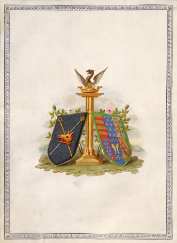
The frontispiece, coloured and decorated in gold, is based on a woodcut first used on the title page of the Statutes of 1822, and as a decorated initial capital letter ‘I’ in the same volume; again on the title page of the Commemoration of Benefactors of 1823; and again on the title page of the Library Catalogue of 1827. In this coloured version, it can be seen that the boar’s head was not silver in this period: this is consistent with other contemporary evidence. The cross and crozier behind the boar’s head are the wrong way around, as they were in the woodcut. The story of the woodcuts is recounted in [1834 pp.200–1], and the subjects of the woodcuts are described in a footnote in the Preface to the Library Catalogue of 1827.
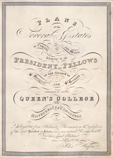
Plans
of the
Several Estates
in England and Wales
belonging to the
President and Fellows
of the college of
St. Margaret and St. Bernard
commonly called
Queen’s College
in the
University of Cambridge
Delineated from Authentic Documents in the possession
of the said President and Fellows and from actual Surveys taken
By their most obedient
and obliged Servant
Alexr. Watford
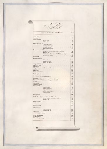 At the time of this atlas, most of the college’s capital assets were in the form of land, which produced revenue by means of rents or fines from lessees. Many of these lands had been held by the college since shortly after its foundation in the 15th century, the lands having been given by early benefactors, or purchased by the college out of money given by early benefactors. One difficulty in correlating benefactions with estates is that the college did not keep any accounts until after the death of the first President, Andrew Dokett, in 1484, so pre-1484 benefactions might not be accurately recorded: indeed, some of them are completely mis-dated in published histories.
Since the atlas was completed in 1825, every land-holding depicted in the atlas (except the college site itself) has been sold.
When viewing each plan in the atlas, one needs to be aware that some plans were made before an Enclosure Award for the relevant area, and some after the Enclosure Award. Some attempt was made to keep this atlas up-to-date with changes made to the estates after the atlas was finished, but not always successfully or completely, and it is not known when the college stopped trying to keep it up to date. In one case, Oakington, Plan 22, there are two plan versions: the original (22a) before the Enclosure Award of 1834, and a second later plan (22b) made after the Enclosure Award.
Although Watford was the lead creator of the original atlas, he employed assistants to help, including his nephew James Richardson. The later updates to the atlas were sometimes by persons other than Watford: for instance, Plan 22b is signed by James Richardson, and Plan 24 Abbotsley (Enclosure Act 1836, award plan 1838) is clearly by a different hand.
Plan 1: The College
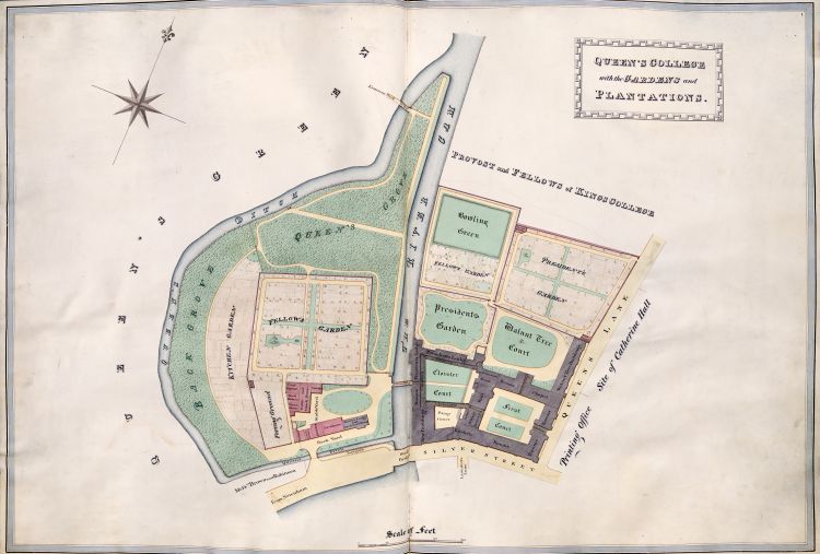 Title: Queen’s College with the Gardens and Plantations.
Plan of the College site as it was 1822–25.
The pieces labelled “First Court” and ”Cloister Court” were acquired in 1447 for the second foundation of St Bernard’s College. The piece labelled “Pump Court” was acquired piecemeal at that time and shortly afterwards.
The land west of the river was purchased from the Mayor and Burgesses in 1475. After this plan was made, in about 1841, the ditch at the south was filled in and the college site extended to Silver Street.
The land north of First Court and Cloister Court, up to the present boundary with King’s College, was acquired around 1544 upon the dissolution of the Carmelite monastery.
Plan 2: Beccles, and Silver Street Cambridge
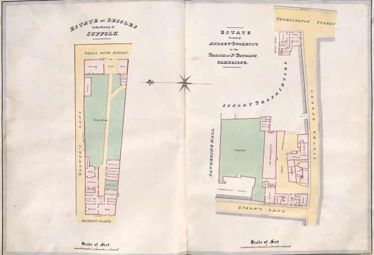 Title: Estate at Beccles in the County of Suffolk.
Blower’s Lane was renamed Market Street in 1865.
NGR TM422904. Google Maps.
Title: Estate formerly Andrew Duckett’s in the Parish of St. Botolph Cambridge.
It is questionable how much of this site was in fact in the personal possession of Andrew Dokett. The Almshouses on Silver Street certainly were. The piece marked “Garden” is a relic of the land acquired for the first foundation of St Bernard’s College, and passed by the King’s charter into the possession of the second foundation of St Bernard’s College, even if Dokett considered it to be his to mention in his will. The house on the corner of Queens' Lane and Silver Street was given to the college in 1459 by William Lasseby of Colchester, to fund sermons. The remainder of the land between the garden and Silver Street was presumably acquired by the college later, and, by the time of this plan, was leased to the University as the site for its printing press.
The history of the shop at 1 Silver Street, on the corner with Trumpington Street, may be read here.
The garden and all the property between the garden and Silver Street was sold to St Catharine’s College in 1836, and now forms the site of their car park and Master’s Lodge. The shop at 1 Silver Street was sold to St Catharine’s College in 1944.
Plan 3: Bermondsey Street East
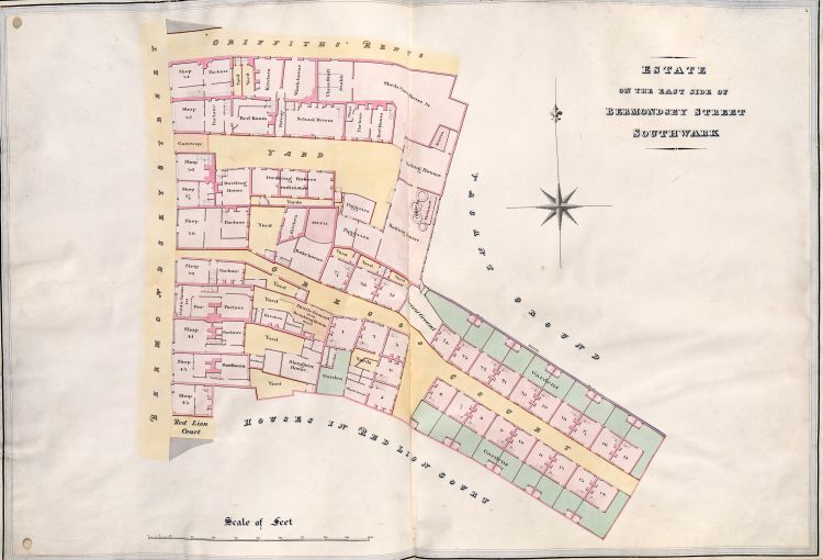 Title: Estate on the east side of Bermondsey Street Southwark.
About 1470 John Marke, citizen and haberdasher of London, gave to the college an inn called the Christopher and nine messuages in Bermondsey Street, in the parish of St Olave Southwark, to found a fellow to pray for him after his death. The first such Fellow is noted in 1490.
In the period of this plan, the property numbering system in Bermondsey Street was different to the present-day scheme: the properties were numbered consecutively, starting on the east side of the street with number 1 at its north end junction with Tooley Street, running southward to number 149 by the church at the junction with Long Lane, then returning northward on the west side to finish with number 284 back at Tooley Street [1810b]. Crucifix Lane was reported to be at 50 Bermondsey Street [1810b]. So, the estate in this plan, showing numbers 34 to 45, must have been in Bermondsey Street somewhat north of Crucifix Lane. William Morgan’s Map of the City of London, Westminster and Southwark (1682) shows the former Christopher Inn in the same stretch. So we can be confident that this plan illustrates the location of the estate given by John Marke, after some centuries of redevelopment.
The site of this former estate is now buried under the far end of the platforms of London Bridge railway terminus, for which development started around 1834.
Plan 4: Bermondsey Street West
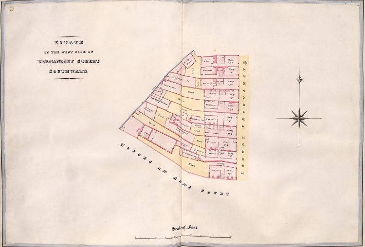 Title: Estate on the west side of Bermondsey Street Southwark.
John Barby (or Berby, Barbie) (d. by 1468), a Mercer of London, gave money at an unknown date to found a Fellowship. In 1495 that money was used to purchase 12 houses in Bermondsey Street, Southwark.
Given that the other Bermondsey Street estate (Plan 3) has been identified with the John Marke benefaction, the John Barby benefaction probably paid for this estate in Plan 4.
The property numbers 273–282 show that this estate was close to the northern end of Bermondsey Street.
The site of this former estate is now buried under London Bridge railway terminus, for which development started around 1834.
Plan 5: Moon Hall Farm
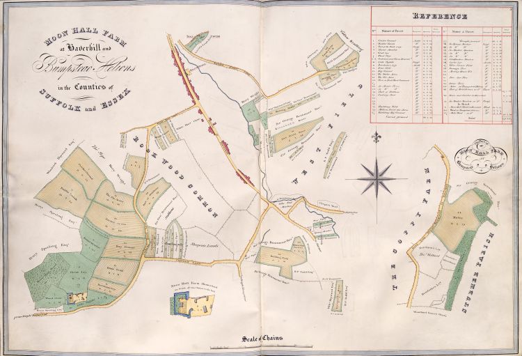 Title: Moon Hall Farm at Haverhill and Bumpstead Helions in the Counties of Suffolk and Essex.
In 1469, Lady Margery Roos (or Ross) gave a large benefaction to the college, to found five Fellowships, later called the “five Senior Fellowships”. Plumptre’s history [1788 f.90r] records “With that benefaction Horsham Hall [Plan 6], Moonhall, Holmstead Hall [Plan 7], Cromeshall [?], part of the Manor of Abbotsley [Plan 24], and Leacham’s at West Wickham [Plan 18] were purchased”. Published histories of Queens’ [1823 p.4] [1867 p.72] reproduce that statement. But that cannot be fully correct: Olmstead Hall was not purchased out of the Roos benefaction: see text of Plan 7. Cromeshall seems not to have existed as a separate estate by the time of this atlas.
Moon Hall, Horsham Hall, and Cromeshall were acquired from George Dawne on 1469 October 10 [Cal.Cl.R. Edw IV v.2, No.471]. George Dawne was amongst a group who acquired those same properties from Thomas Bateman and his wife on 1464 November 18, for the sum of 600 marks (£400) [CP 25/1/294/74, no. 24].
The estates of Moon Hall and Cromeshall were subject to rent to be paid to the Abbot of Battle Abbey [1941 p.428].
Most of the former estate of Moon Hall has now been built over by the town of Haverhill.
Homestead: NGR TL668440. Google map.
Title: The part of Moon Hall Farm at Bumpstead Helions.
For common boundary with The Coppy Farm, see also Plan 8.
NGR TL678435. Google map.
Plan 6: Horseham Hall Farm
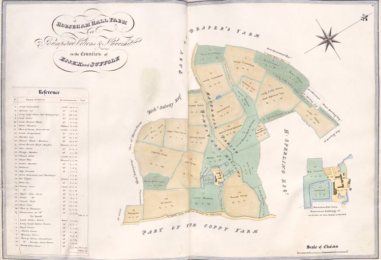 Title: Horseham Hall Farm at Bumpstead Helions and Haverhill in the Counties of Essex and Suffolk.
Modern name: Horsham Hall. Older names: Ersham, Hersam, Heresham.
Part of the Roos benefaction: see text of Plan 5. Purchased 5 October 1469 [1867 p.73]. The name “Cromeshall”, mentioned in the benefaction description, appears here in field names as “Cromshall” in the plan, but “Cromeshall” in the terrier. Other forms seen: Cormershall, Cromeshale.
For common boundary with Draper’s Farm, see also Plan 9.
For common boundary with Haven Farm, see also Plan 10.
For common boundary with Coppy Farm, see also Plan 8.
Homestead: TL662435. Google map.
Plan 7: Holmsted Hall Farm
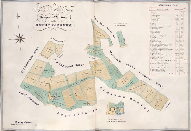 Title: Holmsted Hall Farm at Bumpstead Helions in the County of Essex.
Modern name: Olmstead Hall.
This land was received in 1481, out of the estate of John Skrene (d. 1474), to create a chantry for the dead man, as authorised by letters patent of Richard Duke of Gloucester on 1 February 1478 [2011]. Accounts in college histories suggesting that this land was purchased out of the Roos benefaction appear to be incorrect [OPR f.125r] [1788 f.90r] [1823 p.4 n.d] [1867 p.72].
In 1884, most of this estate was transferred to the civil parish of Castle Camps in Cambridgeshire.
This estate was sold in 1920 to W.S. Kiddy [1978 pp.36–48].
Homestead: NGR TL626406. Map.
Plan 8: Coppy Farm
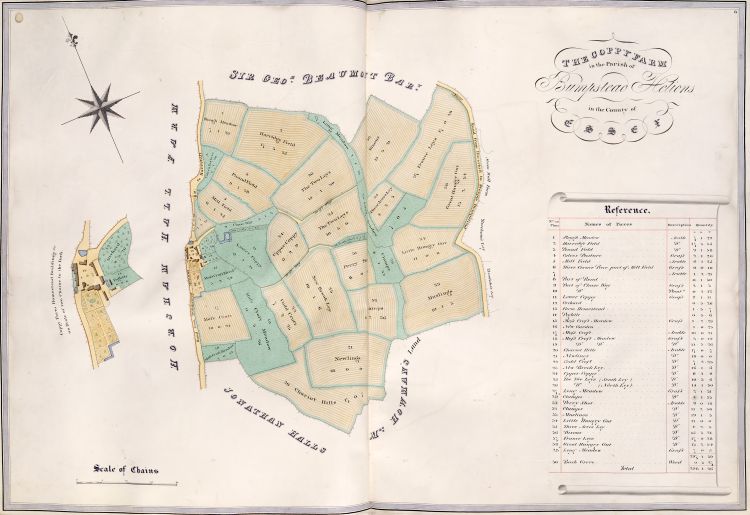 Title: The Coppy Farm in the Parish of Bumpstead Helions in the County of Essex.
Modern name: Copy Farm.
For common boundary with Horsham Hall, see also Plan 6.
For common boundary with the detached part of Moon Hall, see also Plan 5.
Homestead NGR TL665432. Google map.
Plan 9: Lancelets, Drapers Farm, Lacey Fields
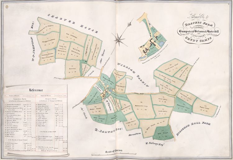 Title: Lancelets & Drapers Farm in the Parish of Bumpstead Helions & Haverhill together with Lacey Fields in the Parish of Shudy Camps
Two adjacent homesteads for two separate farms. Lancelets is now known as Lanchley’s.
For common boundary with Horseham Hall Farm, see also Plan 6.
For common boundary with Haven Farm, see also Plan 10.
Lanchley’s Farm homestead NGR TL648246. Google map.
Draper’s Farm homestead NGR TL647246. Google map.
Plan 10: Haven Farm
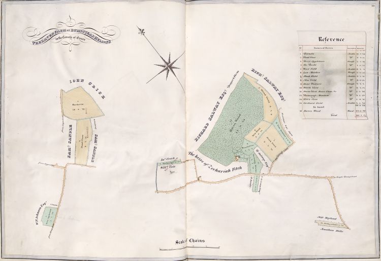 Title: The Haven Farm at Bumpstead Helions in the County of Essex
For common boundary with Horseham Hall Farm, see also Plan 6.
For common boundary with Draper’s Farm, see also Plan 9.
Homestead NGR TL657425. Google map.
The Roods NGR TL651420.
Racketts NGR TL644422.
Perry Appleton’s NGR TL640410. Google map.
Plan 11: Sturmer, Hazel Stubs
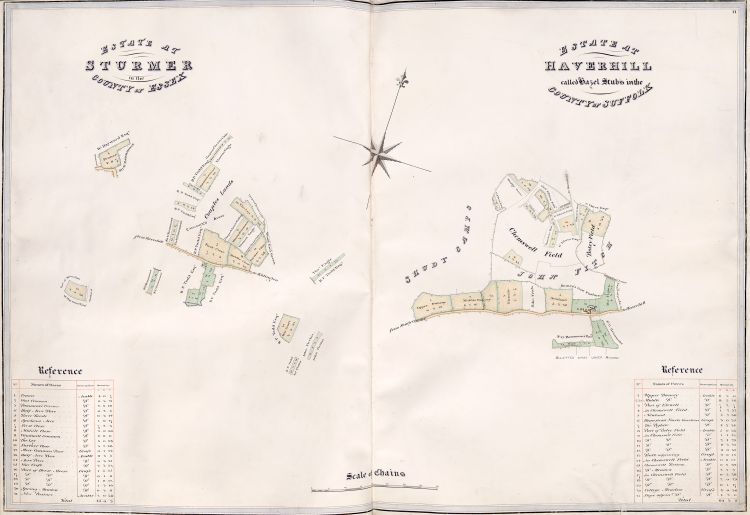 Title: Estate at Sturmer in the County of Essex
This is a pre-Enclosure map. “Wood End Green” was later known as “Woodland Green”. The road shown from Haverhill to Kidington (now Kedington) is now known as “Coupals Road”. Land south of Coupals Road is now a golf course, land north of the road mostly built up.
Approximate location: NGR TL690449. Google map.
Title: Estate at Haverhill called Hazel Stubs in the County of Suffolk
This is a pre-Enclosure map.
Homestead NGR TL654450. Google map.
Plan 12: Motts Farm
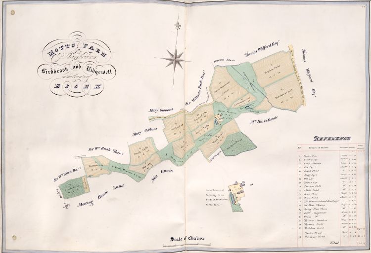 Title: Motts Farm at Stanbourn, Birdbrook and Ridgewell in the County of Essex
John Collinson (or Colynson) (d.1482), Prebendary (Louth) of Lincoln (1455–), Archdeacon of Stow (1460–68), of Bedford (1468–71), of Northampton (1471–), Rector of Over (1472–), founded a fellowship [1867 p.93]. That benefaction of 300 marks (£200) was used in 1478 to purchase lands at Motts Farm (this plan), Stanbourn (Plan 13), and Shadworths at Swaffham Prior (Plan 21) [OPR f.125r] [1788 f.88r] [1823 p.5 n.l] [1867 p.93].
Motts Farm is divided between the historical parishes of Birdbrook, Ridgewell, and Stambourne. It later became known as “Three Chimneys Farm”, located at the end of a track known as Three Chimneys Lane.
Homestead NGR TL717402. Google map.
The “Meeting House” (which also features in Plan 13) shown at the bottom left is the chapel at Chapelend Way.
Plan 13: Stanbourn Farm
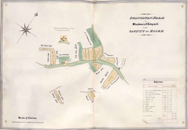 Title: Stanbourn Farm at Stanbourn & Ridgewell in the County of Essex
Purchased in 1478 out of the Collinson benefaction (see Plan 12).
Later known as “Stambournegreen Farm” or “Green Farm”, but this is not the “Green Farm” (otherwise known as “Upper Green Farm”) shown on some OS maps. So probably this is “Lower Green Farm”.
Homestead NGR TL701384. Google map.
Common Piece TL703379.
Whaley TL706382.
Penn Field TL708388.
The road labelled “from Stanbourn” is now “Cornish Hall End Road”. The road labelled "Park Lane" is now “Birdbrook Road”.
The “Meeting House” and “Crook Wood” also feature in Plan 12.
Plan 14: Capel St Mary
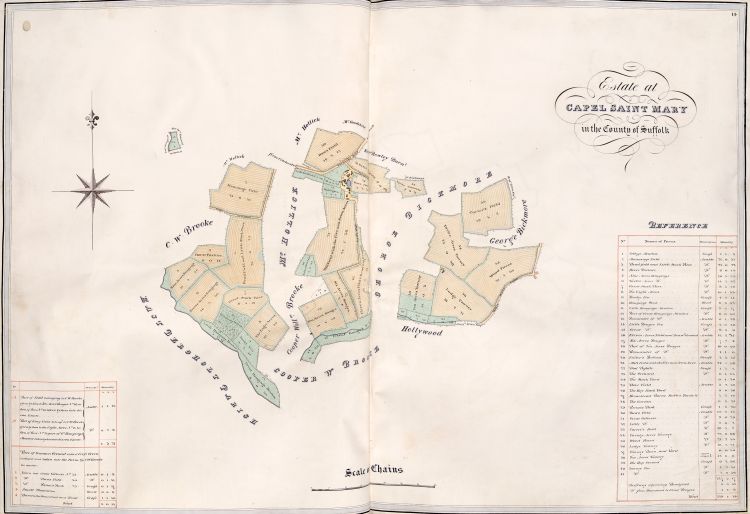 Title: Estate at Capel Saint Mary in the County of Suffolk
Histories record that, in 1481, John Alfray (Alfrey) of Ipswich made an agreement with the college to found a fellowship after his death. It is not clear whether the gift was in the form of lands, or in the form of money from which the college purchased lands, nor is it known when he died, but the lands deriving from his bequest were said to be at Capel, Brentwenham, Barholte, Braham, and Bentley, in Suffolk [1823 p.5 n.n] [1867 p.94]. It is not known to what extent those original lands match the lands shown in this 1825 plan of the estate then existing wholly within the parish of Capel St Mary, centred around Boynton Hall (previously known as Boyton Hall, or Boitwell Hall).
Histories of the manor of Boynton Hall suggest that the Lordship did not come to Queens’ until 1548 [1910 pp.28–9]. There is no mention of Boynton Hall under Capell in the Liber Universitatis Cantabrigiae, 37 Hen 8 (1545–6).
This estate was sold by Queens’ in 1920.
Homestead: NGR TM092372. Google maps.
Detached plot 1 “College Meadow” NGR TM081368.
The road labelled “Turnpike Road” is now called “Old London Road” and has been bypassed by the A12. “Tawney Lane” is now “Bluegate Lane”.
Plan 15: Great and Little Eversden, Fulbourn
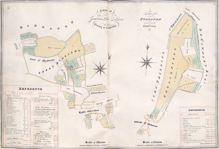 Title: Estate at Great and Little Eversden in the County of Cambridge
The Manor and estate were given to Queens’ College in 1491 by Lady Joanna (or Joan) Ingaldeshorpe (ca.1425–1494), widow first of Sir Edward Ingaldesthorpe (ca.1421–1456), then of Thomas Grey (1418–61), to found a Fellowship.
Preparations for the Enclosure (Act 1811, Award 1814) were the subject of a dispute between the College and the Earl of Hardwicke, a major copyholder and lessee of the College’s lands in the Eversdens, and also a sponsor of the parliamentary bills [1810a].
Some of the land in this estate was lost to the college by copyhold enfranchisement during the early 20th century. The remainder of the estate was sold in 1948, mostly to the tenants.
Manor Farm, Great Eversden NGR TL360538. Google map.
Title: Estate at Fulbourn in the County of Cambridge
Queens’ College purchased this estate from Mr John Ormsby (Ormsbye, Ormesby) of Malden, Essex, in three instalments in the years 1499–1500, 1500–01, 1501–02, financed by a benefaction from Dr Hugh Trotter of £253 6s 8d, for which the college gave him a receipt in 1502. Dr Trotter had earlier been a Fellow until 1489, and had been the first Senior Bursar after the death of Andrew Dokett in 1484. By the time of his benefaction he was Treasurer of York Cathedral. He died in 1503. The benefaction was to found a Fellowship, with income from letting the estate providing the stipend for the Fellow. The college sold this estate to the tenant farmer in 1948.
Original Queens Farmhouse TL521563. Google maps.
Plan 16: Kingston
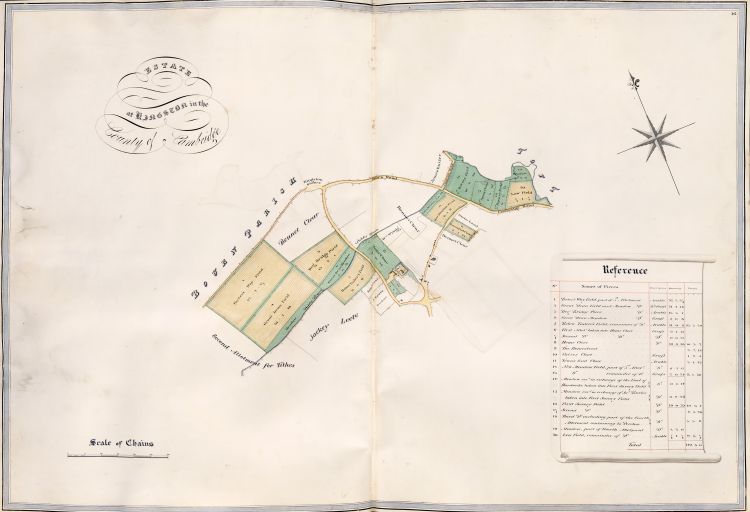 Title: Estate at Kingston in the County of Cambridge.
In 1674, Thomas Clarke, M.A. (ca.1596–ca.1683), rector of Manningford Abbots, Wiltshire, gave to the college an estate at Everleigh, Wiltshire. The income from this estate was to support four scholars, and the purchase of books for the library. In 1735 the Everleigh estate was swapped with Sir John Astley, 2nd Baronet, for this estate at Kingston, Cambridgeshire. The farm become known as “Library Farm” because its income supported the college library. The estate was sold by the college in 1920. The old farm house is now known as the “Moat House”.
Homestead NGR TL344553. Google map.
Plan 17: Haslingfield, Harlton
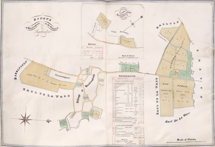 Title: Estate at Haslingfield in the County of Cambridge
This is a post-Enclosure map, and does not show the estate names that existed pre-Enclosure. There is disagreement in published histories concerning Queens’ estates at Haslingfield. The Victoria history of Haslingfield parish (quoting Queens’ archives) states that Queens’ acquired two farms at Haslingfield: “Prisot’s” in 1475 [1973], and “Sterne’s” in 1495 [1973]. But the Commemoration of Benefactors [1823 p.5] (based on Plumptre’s manuscript history [1788 f.90r]) states that it was the benefaction of John Drewell (or Druell) in 1494 that enabled the purchase of “Prisot’s”. That account is confused, as Drewell had died in 1469 [ACAD], and 1494/5 was merely the date of a deed between the college and Drewell’s executor, William Wylde [CU archive]. Dr John Drewell (or Druell) was Treasurer of St Paul’s Cathedral, London, from 1458 to 1467. He was a graduate of King’s Hall, but perhaps later a Fellow of Queens’ (there is no record). The college sold all its Haslingfield properties 1945–50 [1973].
Plot 1 was later known as “Spring Hall Farm” on OS maps.
Plot 31 is today known as “Stearne’s Yard”, on the High Street.
Plot 1 NGR TL405542. Google map.
Plot 31 NGR TL 4057 5213. Google map.
Title: Estate at Harlton in the County of Cambridge
By his will dated 5 April 1474, John Raven, clerk, gave to the college (a) lands at Buckworth, Huntingdonshire, and (b) annual rents of 16s. from lands at Guilden Morden, Cambridgeshire, in order to found a bible-clerk. By 1475/6, the college had sold the lands at Buckworth [1867 p.84–5]. The lands at Guilden Morden were sold in 1530, and lands “late of Dr Manfeld” were purchased in replacement. These replacement lands were said to be in “Eversden” [1867 p.188], but the Commemoration of Benefactors identifies them as being in Harlton [1823 p.6 n.v]. The two fields in this plan lie in the parish of Harlton, and are the only ones in the Estate Plans of 1825 to lie in Harlton, but the north-western edges of these fields constitute the parish boundary between Harlton and Little Eversden, so it would be a not unreasonable error to speak of them as being in Eversden. On the other hand, the Victoria history of the parish of Harlton gives an alternative source of land in Harlton coming into the possession of Queens’ College by 1482 [1973]. Whatever the origin of these lands into the college estate, they were sold in 1920 [1973].
The “Orwell May Pole” shown in the plan no longer exists, but was located at NGR TL 36730 51540. Google map.
Plan 18: West Wickham, Coton
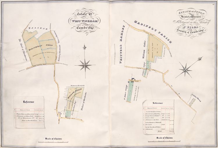 Title: Estate at West Wickham in the County of Cambridge
Lands in this parish acquired by 1484. Map is after enclosure of 1812. Estate sold in 1920 [1978 pp.191–198].
Homestead NGR TL 6136 4927. Google map.
Title: Estate at Coton and in the Hamlet of Whitwell together with an Allotment in the Parish of St Giles in the County of Cambridge
The part of the map in Whitwell is before the Barton enclosure of 1840; the part of the map in Coton is after the Grantchester enclosure of 1802. Queens’ College Farm is said to have “disappeared in the 1860s” [1973 pp.189–198]: later OS maps show a “Rectory Farm” in a similar position near the church, but that site is now built over. The “Turnpike Road” is now “Madingley Road”; the “Private Road” is now “The Footpath”.
Homestead: NGR TL 4081 5885. Google map.
The “allotment in St Giles” is adjacent to the Coton Footpath just west of the M11: NGR TL 4188 5878. Google map.
Plan 19: Pampisford, Coveney
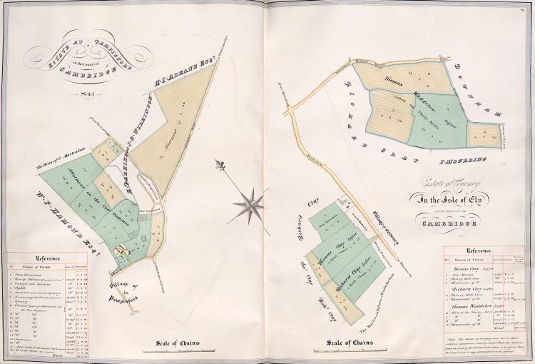 Title: Estate at Pampisford in the County of Cambridge
This map was from after the enclosure of 1801. Prior to that, Queens’ held two estates: first, Saffreys (before 1519, ca.170–187 acres), and then Cockfarnams (by 1524, ca.50 acres) [1978]. The benefaction of Dr John Drewell (or Druell) (see Plan 17) was recorded as having purchased land in Pampisford [1788 f.90r], but whether that land was either of these two estates is not known. After enclosure, the combined estate was known as “College Farm”, under which name it still functions today. The college sold all its land in Pampisford before 1873 [1978], and even this atlas plan is marked “Sold”.
College Farm NGR TL 5003 4853. Google map.
Title: Estate at Coveney in the Isle of Ely and County of Cambridge
In 1676, Robert Mapletoft gave land at Coveney to supplement the stipend of two college officers, and to support two poor scholars [1823 pp.7,9].
Plots 2/3/4/5: NGR TL 487821. Google map.
Plot 8: NGR TL 493832. Google map.
Plan 20: Willingham
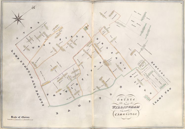 Title: Estate in the Parish of Willingham in the County of Cambridge
Edward Kemp(e) (c.1607–1671), (Matric. 1625. B.A. 1628/9. M.A. 1632. B.D. 1639. Fellow 1632–44 ejected, restored 1660–71), by the terms of his will [OPR f.111v], bequeathed £300 to the college in order to purchase land which would then provide income to the Chapel. This bequest partially paid for the purchase of lands at Willingham [OPR f.125r][1788 f.98r][1823 p.11n.d].
This map shows Willingham before the enclosure of 1853. At enclosure, Queens’ was allotted 50 acres. This estate was sold in 1916 [1989 pp.402–4]
.
Plan 21: Burwell, Swaffham Prior, Dullingham, Chesterton
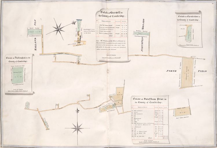 Title: Estate at Burwell in the County of Cambridge
This map was made after the enclosure of 1817, in which the college was allotted 37 acres of arable, presumably that shown in the North Field. At some point, it appears that the homestead was moved from the house shown in the 1825 plan, to “Lark Hall”, at the south-east corner of the 37a field. Queens’ sold Lark Hall Farm to the County Council in 1916 [2002 pp.341–6].
Homestead 1825 NGR TL 5876 6793. Map.
Lark Hall NGR TL 6027 6879. Map.
Hallard’s Fen roughly NGR TL 5676 6793. Map.
North Fen Broads roughly NGR TL 5896 6914. Map.
Title: Estate at Chesterton in the County of Cambridge
Judging by the shape of the plot, its location is probably the site of what is now 196–234 Green End Road. NGR TL 468601. Map.
Title: Estate at Dullingham in the County of Cambridge
There is insufficient context to identify this land.
Title: Estate at Swaffham Prior in the County of Cambridge
Purchased in 1478 out of the Collinson benefaction (see Plan 12). This map shows the results of the enclosure of 1815. The estate was known at various times as “Queen’s College Farm”, “Shadworth Manor Farm”, or simply “Manor Farm”. It was sold around 1923 to C. Y. Woollard [2002 pp.278–85], probably Charles Yorke Woollard (1877–1932).
Manor House NGR TL 5709 6460. Map.
Plan 22a: Oakington, pre-Enclosure
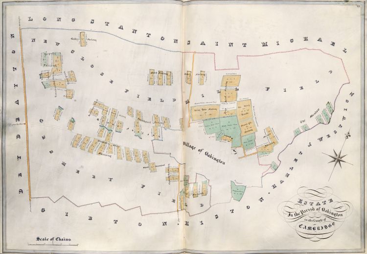 Title: Estate in the Parish of Oakington in the County of Cambridge
Crowland (or Croyland) Abbey in Lincolnshire counted among its possessions the Manor, Estate, and Advowson of Oakington (or Hockington), near Cambridge. At dissolution in 1544, the Crown sold the Oakington manor, estate and advowson to a group of 13 Londoners. By 1549, sole ownership seems to have been in the hands of Anthony Pope [1989 pp.195–9]. In this period, the college was quite prosperous, and was seeking estates to purchase. When Anthony Pope offered the Oakington manor, estate, and advowson to the college, they agreed to purchase the lot for £770, in 1560 [1867 p.295].
As a side-effect of the Oakington purchase, the College became the owner of a considerable amount of the archival records of Crowland Abbey, more than just those relevant to Oakington. These records now form an important section of the College Archives, and have been the basis of scholarly publications on manorial administration in medieval times [see list].
This map of 1825 shows the estate as it was before the Enclosure of 1834. The Manor House (18th C.) is in Plot 1.
Plan 22b: Oakington, post-Enclosure
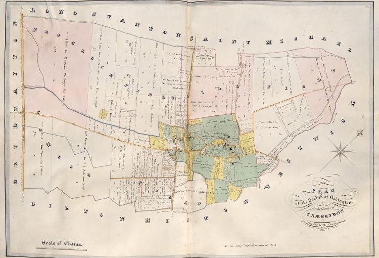 Title: Plan of the Parish of Oakington in the County of Cambridge as Awarded by the Commissioners 1834
Oakington is the only example in this atlas where an estate is shown both pre-enclosure and post-enclosure. This map appears to be a re-working of the map accompanying the 1834 Enclosure Award, re-oriented and re-scaled to match the pre-enclosure map shown in Plan 22a, made by James Richardson, nephew of Alexander Watford who made the atlas and the earlier Oakington map.
In 1924, the college sold the land in pink at the south-east (left), then known as Slatehall Farm, to Chivers Ltd, who sold it in 1959 to W.J. Cowell [1989 pp.195–9]. In 1939, the remaining college land in Oakington (except that in the next sentence) was compulsorily purchased by the Air Ministry in order to create RAF Oakington Airfield. In 1940, the college sold Manor Farm and 30 acres of surrounding pasture to the Papworths, local farmers. A contemporary account of the sale appeared in The Times [1940].
Manor House NGR TL 4136 6489. Map.
Slatehall Farm NGR TL 3932 6370. Map.
Plan 23: Furneux Pelham, Haddenham
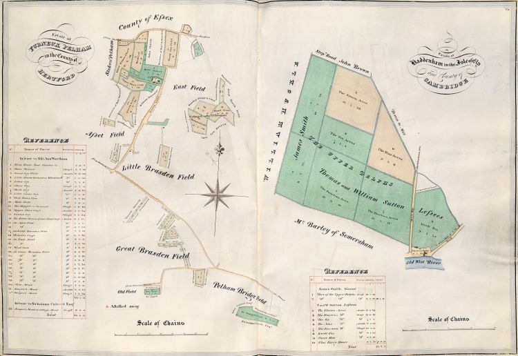 Title: Estate at Furneux Pelham in the County of Hertford
This map was made before the enclosure of 1841. Many of the outlying field shapes cannot be recognised on post-enclosure maps. The compass bearings shown are about 90 degrees in error: the road marked Green Road runs west to east, not south to north. The homestead marked “Up East Farm” was also known as “Upper Farm, East End”, and is now called “Greens Farm”.
Homestead NGR TL 4542 2783 Map.
Title: Estate at Haddenham in the Isle of Ely and County of Cambridge
Although this estate layed within the parish of Haddenham, it was between Aldreth and Willingham, rather than in Haddenham itself.
Assumed location of Flat Ferry House NGR TL 4209 7279. Map.
Plan 24: Abbotsley
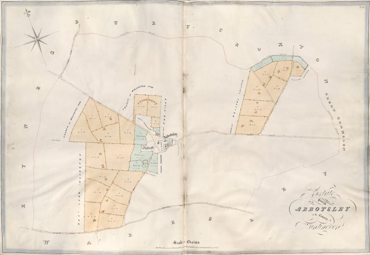 Title: Estate in the Parish of Abbotsley in the County of Huntingdon
Map made after the enclosure of 1838, replacing an earlier map that would have been in the 1825 atlas. The survey was undertaken by Charles Day [1996 p.79], but the mapmaker is unknown.
In 1470/1, Queens’ acquired the manor and estate known as Scot’s Manor, via go-betweens [Feet of Fine CP 25/1/294/75 no. 20], from William Yorke and his wife Elizabeth, widow of the previous owner John Lok [1932 pp.257–60]. This purchase appears to have been partly funded by the Roos benefaction (see Plan 5) and partly by the Drewell benefaction (see Plan 17). There might have been subsequent acquisitions of further lands in Abbotsley. The initial purchase was mis-reported in Plumptre’s MS history as being of “Scoffs Blanner” [1788 f.90r], subsequently reproduced in print as “Scoff’s-Blanner” [1823 p.5 n.p]: these might be mis-readings of “Scot’s Manor”.
In 1927, Queens’ sold 250 acres at Abbotsley [1932 pp.257–60], but that does not account for the whole estate shown in the map.
Locations of buildings marked in red:
Manor Farm: NGR TL 2251 5628. Map.
Vicarage Farm: NGR TL 2274 5659. Map.
Church Farm: NGR TL 2280 5648. Map.
Plan 25: Oakley, Clapham, Wrestlingworth
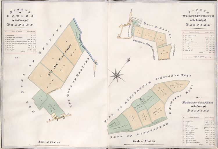 Title: Estate at Oakley in the County of Bedford
This map was made after the Enclosure of 1804. John Stokes was President of Queens’ College from 1560 until his death in 1568. He bequeathed to the college his lands in Oakley, Clapham, and Stebbington (Stevington), adjacent parishes in Bedfordshire [1823 p.6 n.x], in order to endow four Scholarships. Both the Oakley and the Clapham estates were sold in 1877 to the Duke of Bedford, for £6000 [link].
Homestead (46 High Street) NGR TL 0085 5374. Map.
College Farm (not on map) NGR TL 0114 5296. Map.
Title: Estate at Clapham in the County of Bedford
College Farm NGR TL 0432 5357. Map.
Title: Estate at Wrestlingworth in the County of Bedford
Half of the purchase price of this estate derived from the Sedgwick benefaction (see Plan 26) [1788 f.96r].
College Farmhouse (88 High Street): NGR TL 2596 4778. Map.
Plan 26: Yelvertoft & Clay Coton, Great Creaton
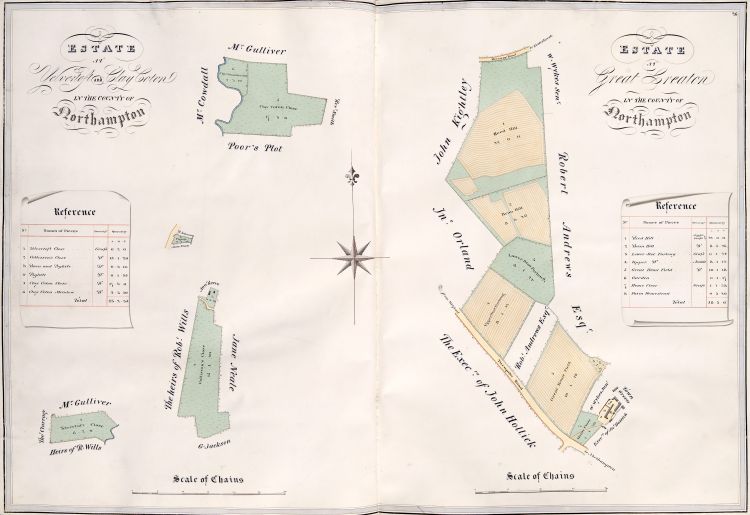 Title: Estate at Yelvertoft and Clay Coton in the County of Northampton
William Sedgwick was President of Queens’ College from 1732 until his death in 1760. He bequeathed to the college two freehold estates and one leasehold estate in Northamptonshire. The leasehold one was sold, and the proceeds used to buy half of the Wrestlingworth estate (Plan 25) [1788 f.96r].
The compass bearings shown are not valid for the Yelvertoft and Clay Coton properties.
Yelvertoft Close: NGR SP 5957 7656. Map.
Collisson’s Close: not located.
Pightle: not located.
Clay Coton Close & Meadow: NGR SP 5860 7733. Map.
Title: Estate at Great Creaton in the County of Northampton
Part of the Sedgwick Bequest 1760.
Homestead: NGR SP 7053 7198. Map.
Plan 27: Great St Nicholas Court
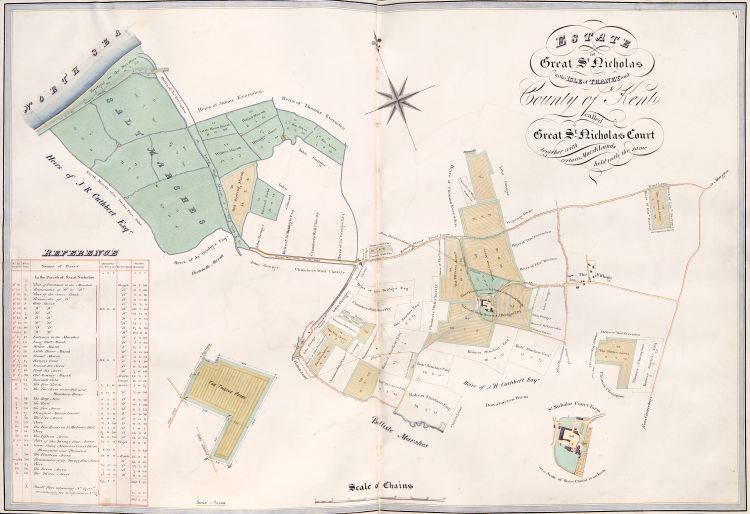 Title: Estate at Great St Nicholas in the Isle of Thanet and County of Kent called Great St Nicholas Court together with certain Marsh Lands held with the same
On 1473 March 5, the king granted a licence allowing Lady Joan Burgh to donate the estate of St Nicholas Court in the Isle of Thanet to the college in order to found a fellowship after her death [Cal.Pat.R. 13 Edw IV Pt 1, m.10, p.394] [1867 pp.81–3]. The estate was re-granted to her for her lifetime, and returned to the college after her death in ca.1493. It is not certain whether her bequest was of Great St Nicholas Court, Little St Nicholas Court, or both.
The parish “Great St Nicholas” is now known as “St Nicholas at Wade”.
Homestead: NGR TR 2596 6689. Map.
Plan 28: Little St Nicholas Court
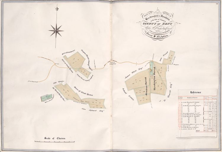 Title: Estate in the Parishes of Birchington & Monkton in the Isle of Thanet and County of Kent called Little St Nicholas Court together with certain lands in the Parish of Great St Nicholas
In late 19th century OS Maps, called “St Nicholas Court Farm”. Now known as “College Farm”. Possibly part of the Burgh bequest (Plan 27).
College Farm: NGR TR 2949 6784. Map.
Tinker’s Hole (Pit): NGR TR 2800 6612. Map.
Lyon’s Marsh: NGR TR 2886 6422. Map.
Plan 29: Gilvachwen
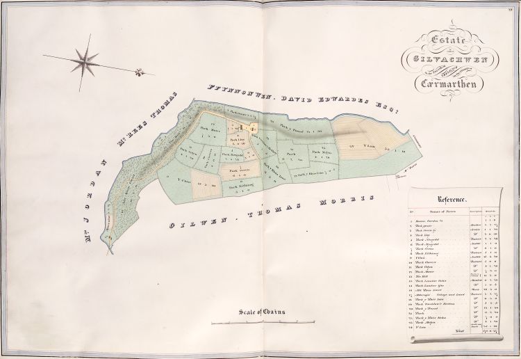 Title: Estate called Gilvachwen in the Parish of Treleach in the County of Cærmarthen
Modern Name: Gilfach-wen, in the parish of Trelech a’r Betwys.
Homestead: NGR SN 2610 2968. Map.
Beacon: NGR SN 2681 3023. Map.
Plan 30: Kilgrammon
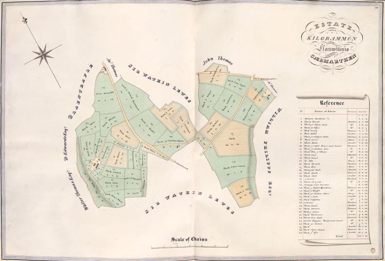 Title: Estate called Kilgrammon in the Parish of Llanwinnio in the County of Cærmarthen
Name on old OS maps: Cil-cryman-fâch.
Modern name: Cilgryman-fach in the Parish of Llanwinio.
Homestead: NGR SN 2348 2588. Map.
Plan 31: Pant-y-maen
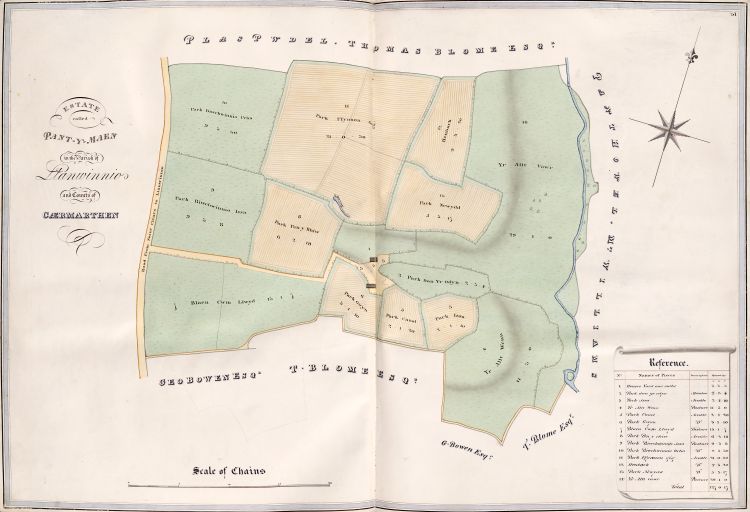 Title: Estate called Pant-y-maen in the Parish of Llanwinnio in the County of Cærmarthen
Alternative form: Pantymaen.
Modern parish name: Llanwinio.
Homestead: NGR SN 2707 2582. Map.
Sources, References, and Further Reading
16xx: OPR: Old Parchment Register, assorted manuscript papers covering college matters roughly 1610–1680.
1788: The History of Queens College in Cambridge, by Robert Plumptre [President 1760–88], QC Library MS101.
1810a: Statement of facts respecting the Eversden Enclosure Bills, by Philip Yorke (3rd Earl of Hardwicke). (part of OCLC 56005876)
1810b: Topography of London, by John Lockie, 1st edition. (OCLC 10590310)
1823: A Form for the Commemoration of Benefactors, to be used in the Chapel of the College of St Margaret and St Bernard, commonly called Queens’ College, Cambridge, edited by George Cornelius Gorham. [Serves as a catalogue of benefactions. Two copies bound together, the first interleaved, with MS. notes by the editor & W.G. Searle, the second with notes by Searle only, in University Library as Adv.b.94.2 (OCLC 55863359)] (OCLC 55861566)
1825: Estate Plans, by Alexander Watford (d. 1844 “aged 60” [Gentleman’s Magazine, N.S. vol. XXII, 1844 Sept., p. 329]), QC Archives 355. [Atlas of plans of all Queens’ land ownings]
1834: A Bibliographical Catalogue of Books Privately Printed …, by John Martin. (OCLC 154807645)
1867: The History of the Queens’ College of St Margaret and St Bernard in the University of Cambridge, by William George Searle, Volume 1, 1446–1560, Cambridge Antiquarian Society Octavo Publications No IX;
1871: Volume 2, 1560–1662, Cambridge Antiquarian Society Octavo Publications No XIII. (Both vols OCLC 3279381)
[In QC Old Library there are (a) a manuscript index for the two published volumes, (b) interleaved editions of the two published volumes with manuscript corrections and updates, (c) preparatory manuscript materials for further volumes].
1899: The Queens’ College of St Margaret and St Bernard in the University of Cambridge, by Joseph Henry Gray; (OCLC 8568413)
1926: New edition, updated. (OCLC 79562186)
1910: The Manors of Suffolk : notes on their history and devolution, by Walter Arthur Copinger (1847–1910), Vol. 6. (OCLC 55543246)
1932: A History of the County of Huntingdon: Vol. 2, ed. William Page (1861–1934), Granville Proby (1883–1947), Sidney Inskip Ladds (1867–1950). (OCLC 498478790)
1940: The Manor Farm: A Long Record Ended, by A Correspondent [John Archibald Venn], in The Times, No. 48616, 1940 May 15, p. 9.
1941: Battle Abbey at the Dissolution: Income, by Allan Evans (1903–70), in Huntington Library Quarterly, Vol. 4, No. 4 (July 1941), pp. 393–442 (ISSN 0018-7895, EISSN 1544-399X)
1973: A History of the County of Cambridge and the Isle of Ely: Vol. 5, ed. Christopher Robin Elrington. (ISBN 978-0-19-722717-6)
1978: A History of the County of Cambridge and the Isle of Ely: Vol. 6, ed. Anthony Peter Mandell Wright (1940–). (ISBN 978-0-19-722746-6)
1989: A History of the County of Cambridge and the Isle of Ely: Vol. 9, ed. Anthony Peter Mandell Wright (1940–) & Christopher Piers Lewis (1957–). (ISBN 978-0-19-722773-2)
1992: Maps, Land and Society : a history, with a carto-bibliography of Cambridgeshire estate maps, c. 1600–1836, by (Alison) Sarah Bendall (1960–). (ISBN 978-0-521-41055-7)
1996: Estate Maps of an English County: Cambridgeshire, 1600–1836, by (Alison) Sarah Bendall (1960–), in Rural Images: Estate Maps in the Old and New Worlds, ed. David Joseph Buisseret (1934–), pp. 63–90, Queens’ at pp. 74–80. (ISBN 978-0-226-07990-5)
2002: A History of the County of Cambridge and the Isle of Ely: Vol. 10, ed. Andrew Franklin Wareham (1965–) & Anthony Peter Mandell Wright (1940–). (ISBN 978-0-19-722783-1)
2010: The Place-Names of Helions Bumpstead, by Neil Lanham, pub. Essex Society for Archaeology & History.
2011: Sir John Skrene, Richard of Gloucester and Queens’ College, Cambridge, by Anne Frances Sutton, in The Ricardian, Vol. XXI, pp. 23–46. (ISSN 0048-8267)
