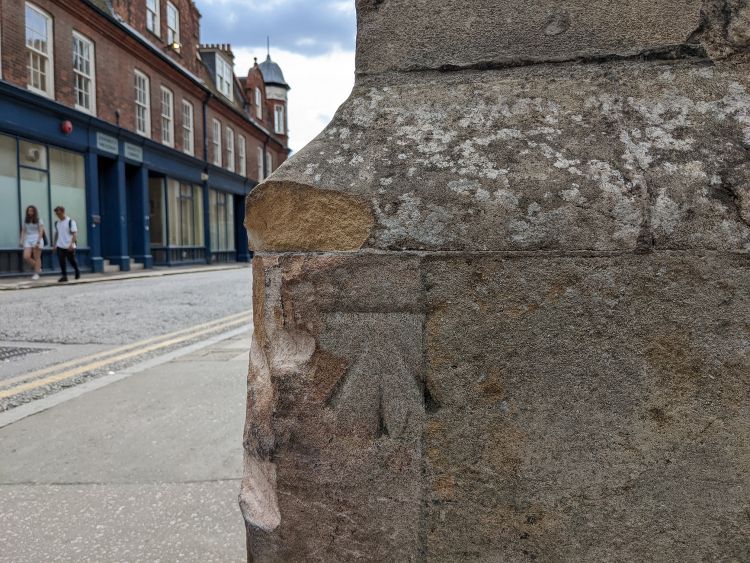
Despite recent damage to the stonework from vehicles cutting the corner too closely, the benchmark itself remains undamaged, by an increasingly narrow margin.
It is not known exactly when this benchmark was cut, but it was probably during the first OS geodetic levelling of 1840–60.
The horizontal line at the top of the benchmark indicates a surveyed elevation above sea-level. The horizontal line is pointed to, from below, by a broad arrow, but that arrow is only an identification and plays no part in conveying information from the benchmark. The locations of benchmarks, and their surveyed elevations, were marked on large-scale maps of the Ordnance Survey, using a broad arrow as the location marker.
In the 1:500 scale town plan of 1888, surveyed 1885–6, with elevations derived from the first geodetic levelling of 1840–60, this benchmark was recorded as being at an elevation of 32·3 feet above a datum of mean sea level at Liverpool.
For the second geodetic levelling of 1912–21, the datum was changed to mean sea level at Newlyn, and the recorded elevations of all benchmarks changed accordingly. This benchmark was thereafter shown on maps as being at an elevation of 30·6 feet above the Newlyn datum.
After the third geodetic levelling of 1951–56, the elevation of this benchmark shown on maps was adjusted to 30·49 feet above the Newlyn datum.
In the 1970s, Ordnance Survey maps were converted to recording elevations in the metric system, after which the elevation of this benchmark was shown on maps as being 9·29 metres above the Newlyn datum. In the Ordnance Survey database of benchmarks, this figure is recorded at greater precision as 9·2933 metres, but this appears to be little more than a direct conversion to metric units of the 1956 figure of 30·49 feet, truncated to four decimal places.
Surveyors now have more modern technology with which to measure elevations more accurately, and more quickly, then the old system of surveying from known benchmarks. The entire network of over 500,000 secondary benchmarks (such as this one) has been abandoned, and is no longer maintained.